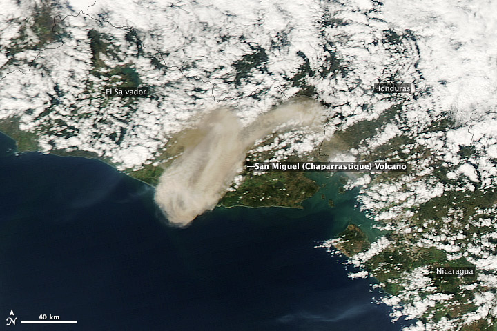
An explosion at El Salvador’s San Miguel (also known as Chaparrastique) Volcano lofted ash more than 71 kilometers (44 miles) downwind on December 29, 2013. Volcanologist Francisco Barahona, quoted by elsavador.com, suggested that the blast was caused by the interaction of water and hot magma within the volcano. However, the strength of the eruption and high concentrations of sulfur dioxide (a volcanic gas) measured by NASA’s Ozone Monitoring Instrument indicated that some fresh lava was involved.
Elsalvador.com reported that the eruption subsided within 24 hours. Additional satellite imagery from December 30 confirmed that San Miguel was quiet.
This natural-color satellite image was acquired by the Moderate Resolution Imaging Spectroradiometer (MODIS) on the Aqua satellite. – Earth Observatory
-
References
- Carn, Simon (2013, December 30) Private communication.
- Elsalvador.com (2013, December 30) El Chaparrastique regresa a la calma, según vulcanólogosAccessed December 30, 2013.
- Klemetti, Erik (2013, December 29) New Explosive Eruption From El Salvador’s San Miguel. Accessed December 30, 2013.
NASA image courtesy Jeff Schmaltz LANCE/EOSDIS MODIS Rapid Response Team, GSFC. Caption by Robert Simmon.
- Instrument:
- Aqua – MODIS
Filed under: News/ Current Events, Volcanic Activity


